|
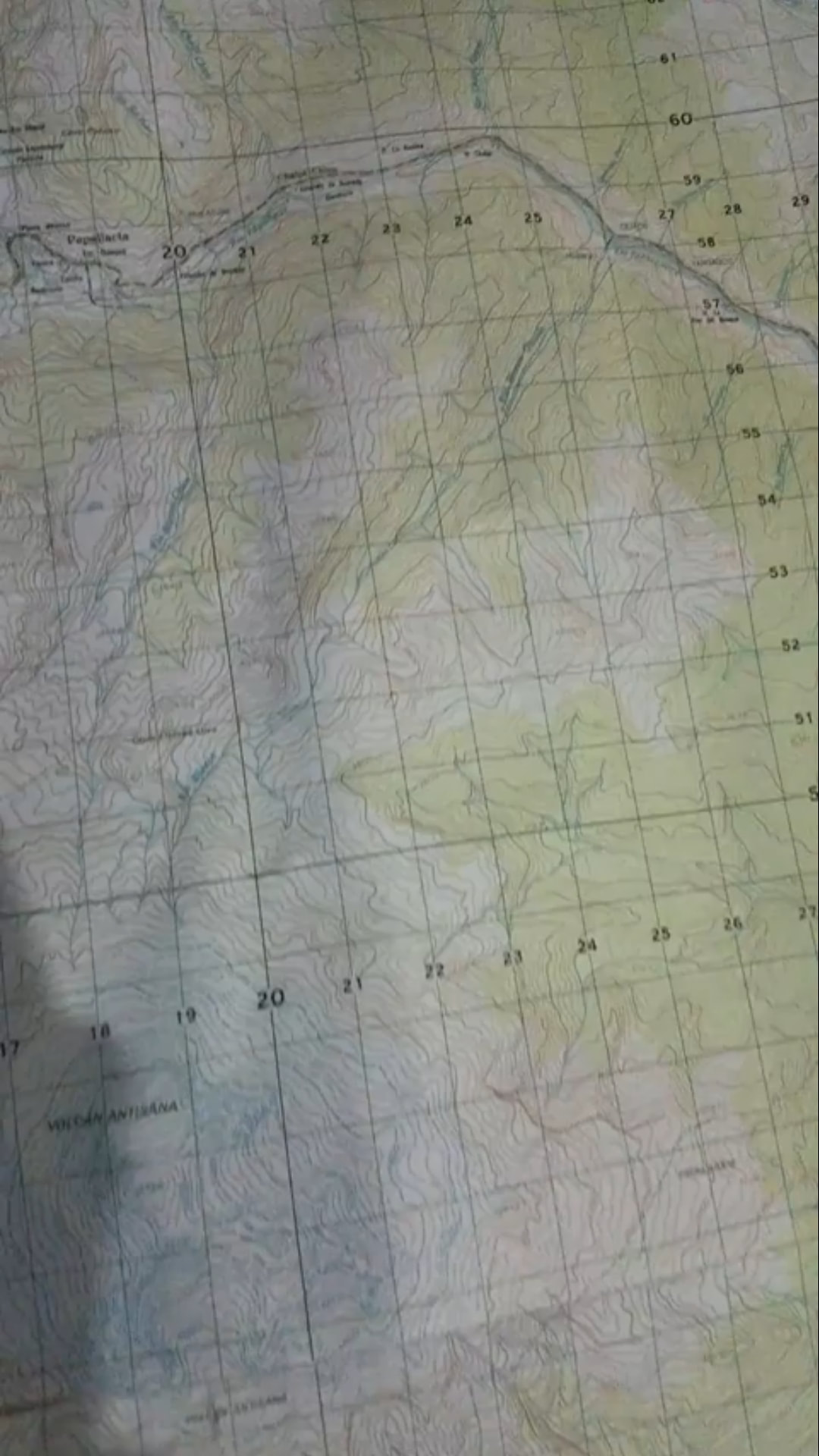
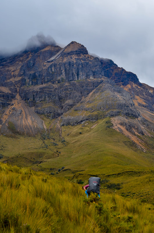
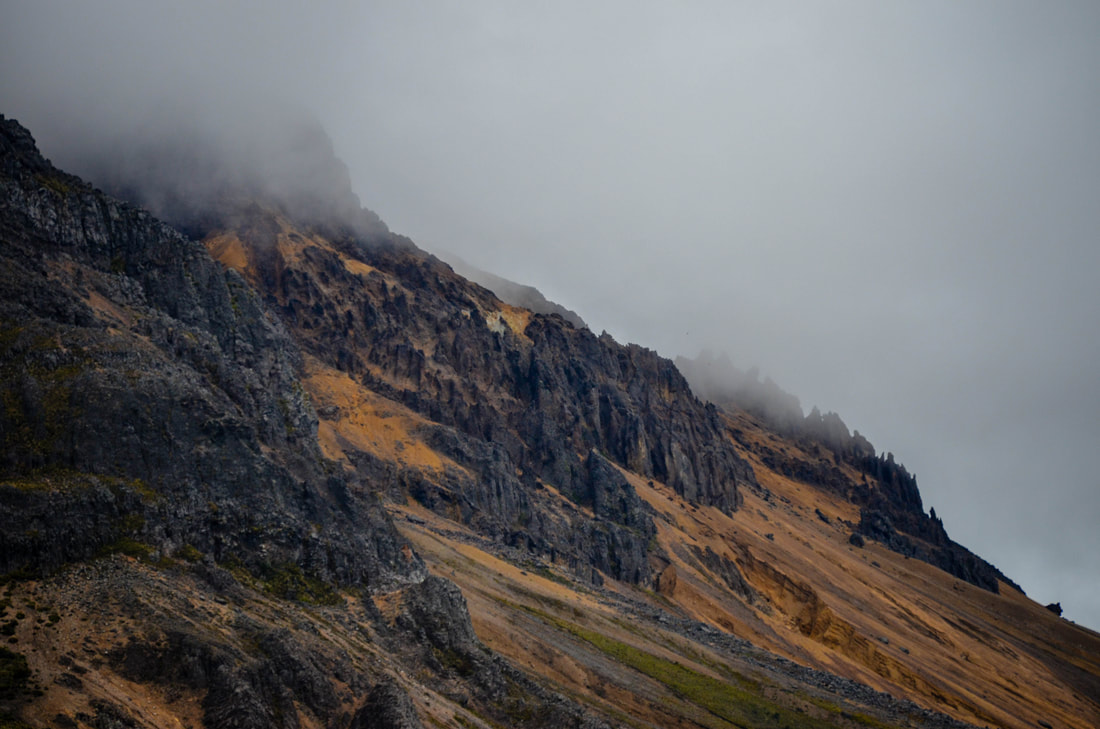
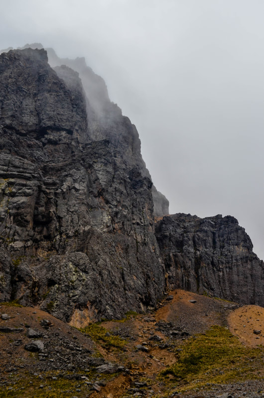
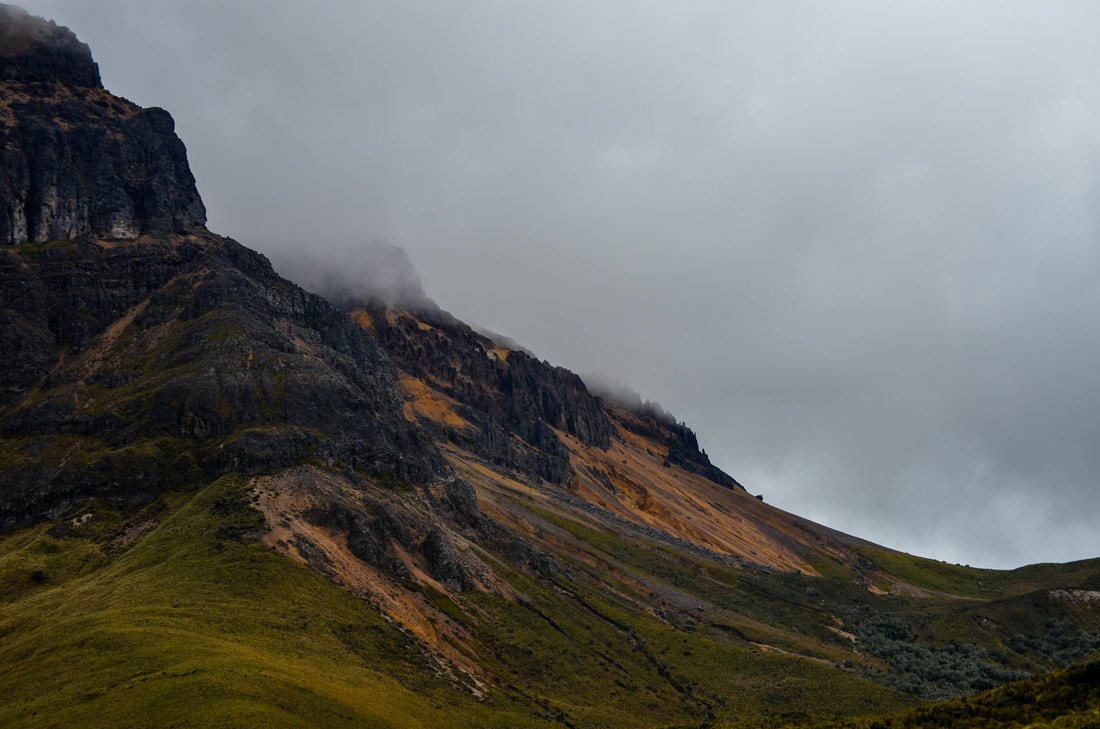
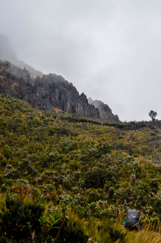
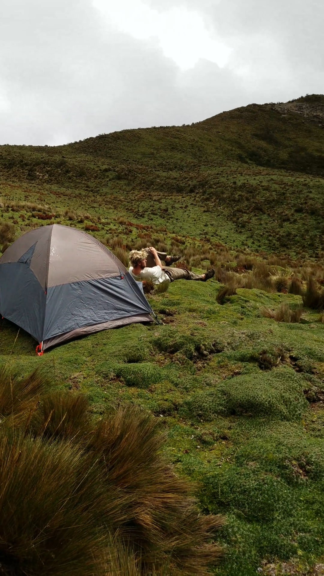
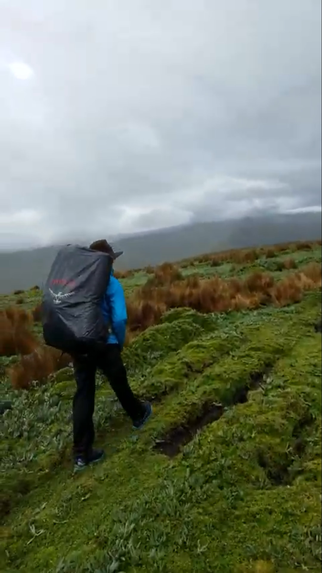
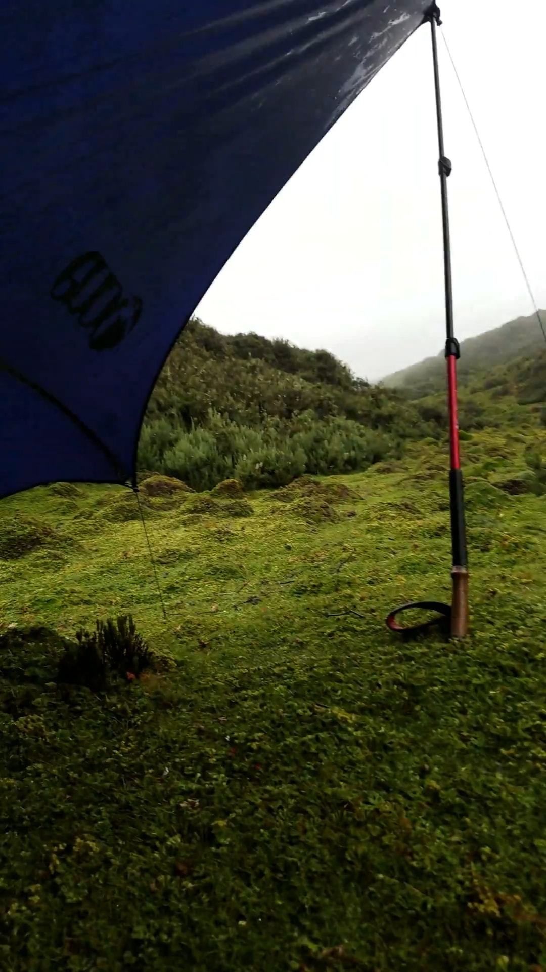
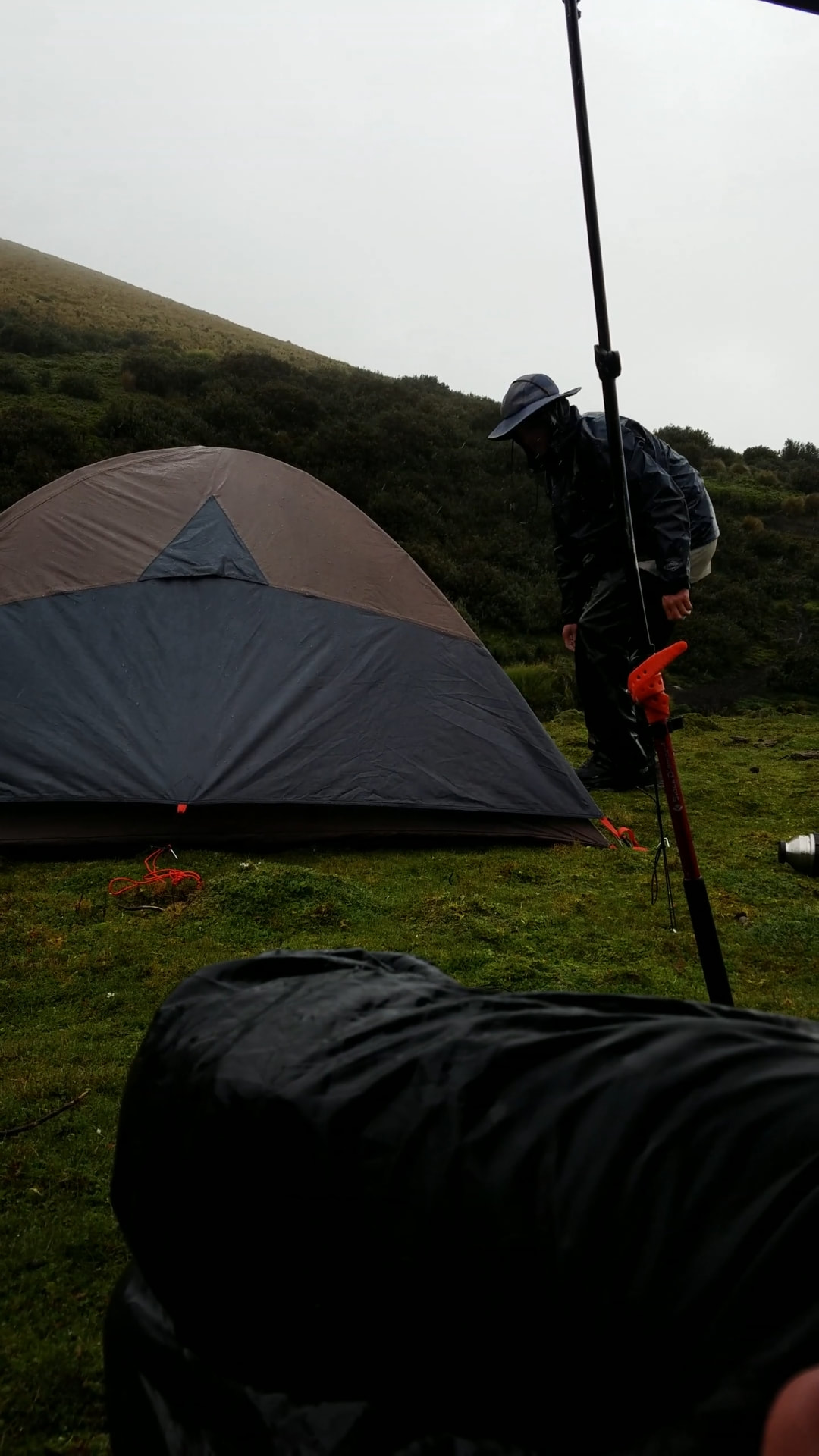
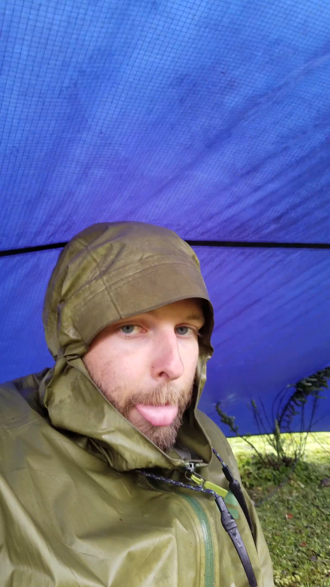
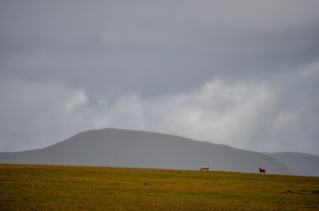
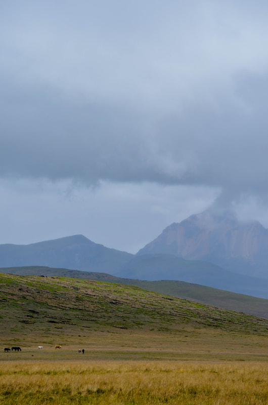
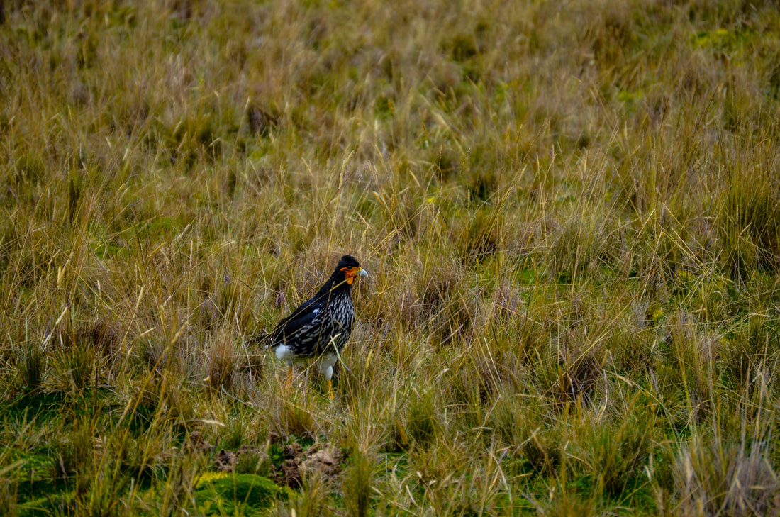
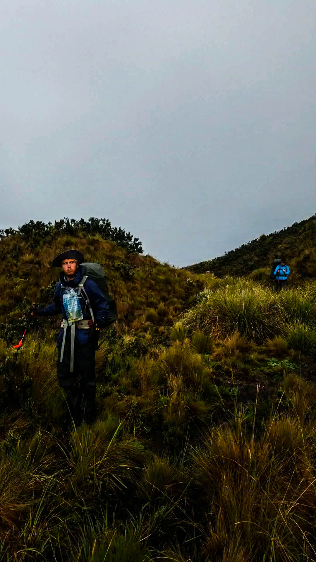
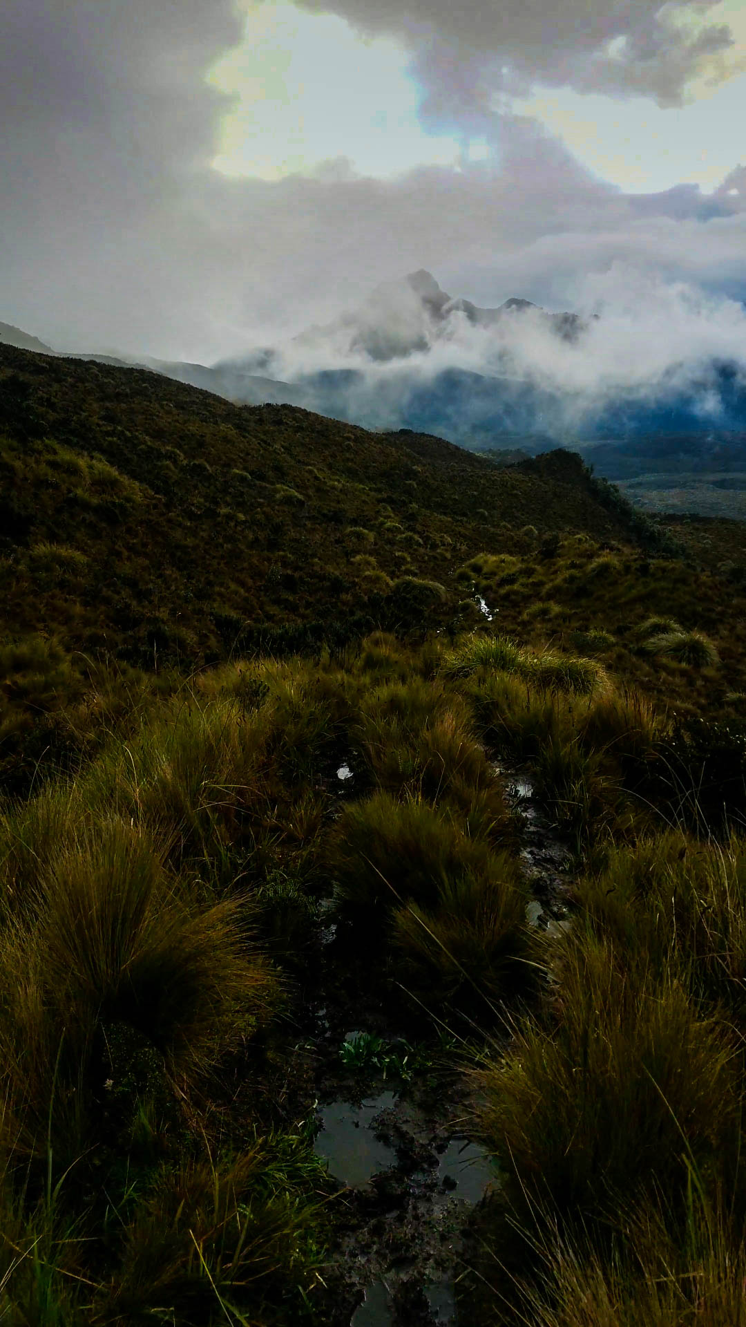
While researching Ecuador's plethora of trail systems, I stumbled across one called El Condor Trek. This trek would take myself and my group through the heart of the Andes. Challenged by 14,000 ft passes, harsh weather conditions and minimal resources, we would spend five days traversing the paramo between Volcan Cotopaxi in the West and Volcan Antisana in the Eastern Napo region. The only map we were able to obtain for these regions was a military survey map from the '80s that included no current path or road systems. Digging through online resources, I found a description of our route deep in the recesses of an old (and I mean old) South American trekking guidebook. With these two physical resources as our foundation, we built what we could into virtual mapping. Using Gaia GPS, we traced our physical resources into our handheld devices and were able to save the data for backcountry use. Additionally, we carried with us a Garmin InReach. This tool allowed us to enter coordinate points, served as an emergency rescue resource and ended up plotting our course through the entire trip. While this trip and its preparation was truly a beautiful and life changing venture, I do not recommend it to anyone untrained in the above skills. Additionally, proficiency in back country travel and compass navigation were imperative in these settings. Now, picking up from last post Returning with friends, part 1, we find Leslie, Zach and myself resting for a day or two in the busy mountain city of Latacunga. Having completed our first venture to the summit of Quilotoa, we retreated to lower ground to restock on provisions, go over our maps and wait for a subjectively good weather window to begin our next trek. As our bus left the city behind on our first morning, the rain began to fall. Scattered nimbo-stratus formations blanketed the valleys running down from the cloaked mountain peaks. Wiping off the thick precipitation from the window of our packed, hot and smelly bus, we stole quick glimpses of our destination. The foothills of Cotopaxi spread their tendrils far out from the mountain's glacial peak. Their rolling features serve as home to Ecuador's oldest farming and Quechuan communities. Hills dotted with stone houses, cobbled roads and grazing livestock. Our bus jolted to a stop under a pedestrian bridge on the outskirts Machachi, breaking our anticipatory ruminations as the driver called our stop. We tumbled onto the street side, dragged our gear out of the cabana underneath and struck off to find a truck to take us up into Cotopaxi National Park. Our hired vehicle bumped and bounced through the unforgiving country roads, as we entered into the heart of the clouds we had seen from the bus. Soon our head to toe rain gear was put to the test and we began to revel in how absurd our aspirations truly were. At the time, I did not know what we really were getting ourselves into, but it was the single moment in which I was hit with the reality of our intentions and a raw wave of adventure fueled giddiness. Soon, I became copilot to our driver in an attempt to find our trailhead. He listened, bemused, as I explained what we were planning to do with our gear. Whether he thought we were crazy or that my Spanish was not so great, he left us at the beginning of our path and bid us good luck. This is where the adventure began, above 12,000' in the cold and wind of the paramo. 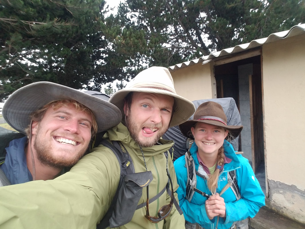 Intrepid adventurers at the trail head So we dove in! Like stepping through an unseen blind into another world, the Andean paramo immediately opened up around our feet and brought our absolute insignificant size into objectivity. Resilient and green vegetation carpeted the ground around us as every path seemed to have developed a lively stream. The complementary pigments of green chlorophyll, orange roots and umber soil burned up from the swollen earth, giving the entire landscape an over saturated quality that confused our eyes and my camera. Rolling our way through the volcanic polyps, we descended into a river valley and took stock of our location at an abandoned military outpost bordered by a rushing river. Upon crossing the muddy waterway, we were met with a thick fold of pine trees and no apparent pathway through the center. Above their pointed heads poked the jagged profile of Volcan Sincholagua, serving as a gateway to our trek and the first pass that would take us above 14,000'. Using this landmark, we set our compasses and found the path of least resistance through the swath of pines. Shortly thereafter, we emerged on the other side, unscathed by creatures of the wood, on trail with a clear orientation and directive point. This began our climb. Over the next two hours we picked our way constantly upwards, following a faint trail through the tall grasses. The occasional cigarette package littered our path, with graphic images warning against physical defects in the consumer. Following these last remnants of civilization, we worked our way up the leeward aspect of Sincholagua to the pass, 1,800' above us. These miles were grueling. Lack of oxygen took the vitality out of my lungs as my legs burned and trembled under the strain of my pack. My whole body wanted water, food, rest and a breath of thicker air. Our trio slowly spread apart as we each tackled the task at hand at our own speed. The rumor of a path was slowly eaten by a cascade of rockfall and scree, covering the volcano's flank. Green grasses and lively waterways gave way to cold red and grey igneous graveyards. As the oxygen became thinner, our surroundings became stark and intermingled with the sensation of each breath. Blood pumped through my veins and my head seemed to pulse with its revitalizing movement, my sight morphed by its intensity. The whole experience seemed somewhat distant as I rested among the jumbled boulders that made up the saddle ridge. There is nothing as satisfying as resting after great spurts of exertion. Leslie and Zach breached the pass soon after and we breathlessly surveyed the valley behind us. We now sat on the Southwestern ridge of a rounded triangle of three peaks, the impression between the three high points creating a boggy wetland. Before us, the trail followed the edge of this sodden dip, bringing us to the Northwestern saddle and around the outside of a smaller peak. As we made this transition, the mood seemed to drift from a semblance of the comfortable to an overwhelming rush of the unknown as the heart of the Andes opened up below us. No human development for a long days travel in any direction. The sun was setting and Zach was not feeling too hot. We pushed on for another half mile to lose some elevation and set up our tents in the sheltered impression of a massive boulder. Dinner was ramen and eaten in silence, as we watched the paramo moths throw themselves into the fire warming our tea water. Early morning found us hazily waking from a night of gasping breaths and wild semi conscious dream states. Silent and stiff we gathered our newly lit surroundings as the last of our water boiled for our morning tea and oats. Bright sun rays snuck through the patchy cloud cover to warm our achy bodies and dry our dew covered gear. Warmed by our tea and breakfast, we hefted fully laden bags and started out over the paramo marshes. Promised by our maps and confirmed by our morning recon was a lake on the other side of a wide and sodden plateau. Nestled in a reprieve on the lakes hill sheltered shore, we drank our fill and splashed our faces in the cold mountain water. Inspired and refreshed, our spirits lifted and we found humor in the darkening clouds and quickening winds. After filling our dromedary with enough water for two days and the miles between us and the next source, we donned our rain gear and gaiters, repositioned our packs, ate a few nuts and turned our backs to the rippling surface of the lake. There are many lessons hidden in the paramo. One being that everything looks like a hoof print. Whether it is the imprint of a gaucho, a wandering steer or a tough-ass chupacabra is up to the interpreter. Whether or not to follow the hoof prints is again, up to the interpreter. Unfortunately I steered us in the footsteps of a few chupacabras before we gathered atop a nearby ridge to recuperate and collect our wits. As we checked our GPS devices, we found that the darkening sky had shut off all digital location ability and completely disabled our digital resources. This is a perfect example of why one should never travel the back country solely reliant on technology for guidance. Luckily, we had our map from the '80s and so while sheltering it from the newly falling raindrops, we found our location and established a new heading. Luckily, the ridge we had gathered on pointed us directly through two silent valleys and as the heavy clouds moved over our heads from open hollow to hollow, we took our first steps towards that night's campgrounds. Skirting shin high puddles as well as we could, we bent our heads into the frigid wind and the first falling of hail that peppered our surroundings. As the ridge expanded and merged into a long river valley, our distinct course escaped into sprawling slopes of grasses that flattened all depth perception and sense of distance. After finding a high point, we took a brief reprieve in the hailstorm to collect our surroundings and choose an entry into the fields below us. The first thing that caught our eyes was the obvious patterning of curated land, the herds of cows dotting the slopes and the collection of small buildings surrounding a central hacienda. This valley had been in the written description we had found in our prior research, the occupants as well. The description explained that prior trekkers had experienced difficulties crossing through this valley due to the owners of the hacienda and land use permissions. Hoping to avoid this entirely, I had planned to cross above the ranch land and circumnavigate through the highlands to rejoin the trail before pushing to our next mountain pass. With this course of action in mind, we started descending the rolling valley walls with the hacienda to our left. The moment we left the open plateau of the ridge, we sunk to our thighs in thick, wet grasses that significantly slowed our process. The hail had resumed with renewed vigor, an incessant pattering on our hoods that pushed our gaze down toward our feet. Cow trails wound throughout the field and made for a confusing maze of dead ends and faux paths. Eventually the hacienda dropped out of sight and we found ourselves blundering further Southeast. This felt wrong and we stopped a handful of times to redirect ourselves before getting drawn out into the empty highlands. At last, we came to a drainage ditch that fell away below us in a direction we deemed appropriate for our intended heading. The break in grasses quickened our pace and brought us down to the banks of a small creek that cut to our left and back down towards the hacienda's valley. A sneaking suspicion told me that the easiest course would be to face the local population of these wild highlands and (hopefully) cross through their property. Making one last effort to avoid this, Leslie, Zach and myself climbed the opposing valley wall We found that the cattle torn ridge was guarding a vast stretch of wetland edged with cloud capped, rolling peaks. We picked up rain and hail storms in the muted light as they swept across the expanse and over our perch. Intimidated by the unknown and encouraged by our map, we turned on the ridge that paralleled the creek and followed it down, towards the hacienda. By this point, our spirits had been successfully dampened by the interminable downpour and a feeling of defeat had crept into our collective mood. As we stood above the hacienda before our final descent, we made the decision to set camp once we made it past the populated valley. We had only hiked five miles. With our contingency in mind, we dropped into the valley, skirted some massive bulls and took our first steps onto curated road. With a sense of apprehension, we passed our first sprawling low roofed building. Although there were vehicles in front, laundry hanging below their roofed stoop and smoke streaming from the chimney, the current deluge gave the inhabitants no reason to leave their comfy lodgings. Gusts of buffeting wind convinced the inhabitants of the dwellings that no one in their right mind would be out on a day like this. Soaked to our core, we came across the first inhabitant that dared to brave the elements. The scruffy golden cow dog bayed out its concern as we unlatched a gate and moved up the road to the main house. As he sprinted ahead of us, a battalion of his furry compatriots came bounding down the road to meet with their watch. They gathered in a curious half circle across our path and accosted us in gravelly tones. We assured them we had no ill intent and with fearful steps, we moved through a gap in their ranks. It was not till we felt secure enough to look around us that we found the pair of wondering eyes watching us from the stoop of another dark cabin. Bent from age and a life of ranch work, a man and woman watched our progress with an indifferent gaze. Our sheepish salutations were not returned and we could feel them watching us as we ascended one final hill, past the main ranch house and into the paramo beyond. A sense of relief took us as we moved out of sight of the hacienda and into the fields behind it. Although it was still obvious we had not passed out of the ranch's land, we found an empty stream bed that was flat enough for us to set up camp. It was 3pm and we had hiked all of six miles that day. Having the majority of the afternoon to kill, we set up our tents and used my one person tarp to string up a rain cover. With little room for two, let alone three, we clumped together under the awning and did our best to stay dry while we prepared our food. Leslie was the first to escape to her tent, I was quick to follow suit. As soon as I lay myself down into my sleeping bed, a wave of nausea and aches coursed through my body. Brought on by the elevation, dehydration and exhaustion, they kept me in the tent for the rest of the evening. As Leslie and Zach cooked themselves dinner, I could hardly find the motivation to turn over in my bag. I fell into a fitful night sleep with the sound of the ever present rain battering the walls around me. SUN!! Sweet warm rays woke us the following morning. Rainwater evaporated all around us as we took advantage of the lucky moment to lay out all our drenched gear, in hopes that we could find some comfort in the day ahead. Each of us spent the first waking hour digging deep, finding our internal motivation to make up the extra miles we had cut the day prior. With camp packed and slightly drier gear, we moved onto our longest day yet. Our aim was to reach the second highest pass of our trip. A saddle between Antisana's 18,714' summit and a pseudo peak named Chosalongo. Because of our loss of miles, this meant a 13 mile hike ahead of us with a 14,410' pass to finish out the day. With leaden legs somewhat loosened by the sunny morning, we crossed our first small saddle pass and began our descent into the sprawling valley that surrounded Antisana's feet. The peak hid its face within the clouds as we crested the hill and left the hacienda's boundaries by a rusted gate in ill repair. Paramo animals were abundant in the warm steaming grasslands. We watched as hawks circled each other; small rodents evaded our eyes leaving rustlings and disturbed grass; a mother deer and her offspring sprang away from us, flashing a warning sign with the snow white fur that covered their upturned tails. The prior day's memories were as an acrid flavor in our memory, yet they kept our eyes trained on the threatening rain clouds as we approached an open swath of grassland. To the East, a strong river flowed down to the edge of our field and followed it North to the beginning of the Antisana Reserve. As we picked our way through the flat lands, glimpses of the glacial peak teased us through the cover of clouds. Occasional blinks of sunlight reflected off the snow covered features and struck us in the flats, so far below. Enjoying the easy terrain, we meandered through the field. Each of us found the route best fit for ourselves and trusted in the others to do the same. The crossing was uneventful yet so long. We started to get a sense for how warped distance appears at such a high altitude and in such wide open grounds. On the far end of the wetland, we picked up a road that the map told us would lead to the entry of the Antisana Reserve. The pavement felt foreign under foot as we followed it towards a small group of huts in the distance. As we gathered nearer, we saw these huts to be populated. Not expecting any of this, we wandered up quite bemused to what was now obviously a control point with a team of uniformed park guards. They ignored us as we took stock of this strange junction. A map seemed to tell us that a permit was required to pass into the Antisana Reserve. This had to be wrong, there had been nothing mentioned about the control point, much less a permitting system! Hoping that our Spanish had failed us, we approached the guards with the intention of passing into the park beyond. Quickly, what had begun as a sun filled day, flashed to the gray of disappointment and frustration as we were told there was no access to the park. In the ensuing conversation we learned three things: bribes were not accepted, not only would we need a permit, we would also need a guide, and our only option moving forward was to retrace our steps to Cotopaxi. Fuck! In a haze of disbelief, we turned back down the road. My mind was racing, not only were we not going to finish our intended trek but it was no longer a viable option for my trip itinerary. I would be lying if I said I did not feel deflated, the wind driving my motivation dying and leaving my inhibitions marooned. I believe that our next decision was driven partly by my pure frustration. I turned to my companions and suggested cutting into the park over a nearby pass, circumnavigating the control point and bringing us back on course with only two miles being added to our trip. I cannot say that this decision was moral. I understood why we were required to be guided and permitted. I understood the impact we had on the ecosystem that held one of Ecuador's largest watersheds. I understood that what we would be doing was illegal. And to be honest, I did not care in that moment. Two years of disappointment and rebounding from hits outside of my control insisted that I not back down from this. This was a setback we could get around, it was in my control. As soon as we were out of sight of the control point, we made our move. Dropping down the embankment of the road, we started out over an open field towards a break in the hills that would bring us into the park. On high alert, we snaked through the tufts of greenery and cow bones that littered the ground. A motor bike buzzed into life on the road and we all ducked, fully aware of how visible we were out in the open. Luckily, the bike moved on and we made it to a winding cow path set down into an old water drainage. Securely camouflaged from the road, we took deep breaths of the thin air and started up the ditch. Emerging from the top of the ditch, we found ourselves looking out across the foothills of Antisana and the towering peak reaching up into the clouds above them. From this vantage point, we saw the control point far down to our right, the river that our initial path would have followed and our final pass tucked neatly into the side of Antisana. This brief pause also brought about an important realization. We were all out of water. Having not filled our bags and bottles since the morning prior, we had completely depleted our stores. The plan had been to fill from the river in the valley below us, but now we had to push on to the next source: a lake at the summit of the 14,410' pass that lay ahead of us. With intention set on getting to water, we began what looked like a quick traverse of a large plain that lay in front of us. From our high vantage point, it had looked like a vast flat below us. Now that we had descended from the vantage point, we found the plain to be a sturdy and prolonged uphill. an uphill that climbed 1,500' to reach our final pass. While normally this kind of elevation gain would not be a major challenge, add the Andean elevation and climate to the mix and you have one hell of a slog. Dazed by dehydration, we crept our way up the flanks of the mountain, barely keeping each other in sight as we each meandered in the same general heading. My companions' frustration occupied my mind and put a fire under my butt. And even with my quickened pace, the hill stretched out beneath our feet in a seemingly endless ascent. Breaching the top of that hill was viscerally good. With little energy to enjoy our surroundings, we had found ourselves at the feet of a giant. Volcan Antisana reared its head out of the unassuming earth to punch a hole in the iron grey clouds above. We moved through the molasses of dehydration, our eyes bouncing back and forth between our footing and the monolith that filled our current reality. Bitter winds dashed clouds to pieces against the glacial teeth of the volcano. A feeling of exhilaration and pure happiness rained down on us as we dropped our packs heavily to the ground. It was almost all we could do to not lay on our stomachs and quench our thirst straight from the lake that lay in front of us. At 14,410' this saddle lake was our final hump before a ten mile descent into the town of Tambo.  Leslie and Zach don't want to hang out with me It was about 1pm when we filled our bottles and bags at that lake. After we all had our fill of water and food, we set to planning our next course of action. We had only planned to make it to this lake but we had favorable weather and it was early. Additionally, the wind that we found ourselves battered with did not bode well for an overnight on the saddle. We chose to continue forward, aiming for a lake nestled in the foothills well below our current location. The maps told us that this would take us down 2,500' in the course of four miles. What a breeze! After three grueling days of constant uphill travel, a trail profile like this made us giggle with anticipation. So once again, with fuel in our bodies and high hopes, we hefted on our packs and turned into the wind. The first mile was a dream. Gently sloping hills gave us time to look out and see the beauty of where we were. As far as our eyes and imaginations could take us was a world of thick green moguls. A never ending spread of peaks and valleys, lakes and rivers and mud. Starting mile two brought us into the edge of this world and there we met and became accustomed to the world of mud. Where the highlands had thick grasses to step on and provide safe passage through wetter grounds, what we were descending into was a land ruled by wet soil. Solid ground lived below half a foot of mud, paths were creeks and creeks were rivers. But for as wet and squelchy as we were, our spirits still held high as our path followed a persistent down hill route. Two hours or so into this leg of the journey, we stopped in our tracks as a lake bed opened up below us. This had to be the lake we were aiming for! Jubilantly we began descending. We were so high on the valley wall at this point that as soon as we started down the slope, we found ourselves making progress in a controlled slide through the slick undergrowth. Our bumbling course brought us to the banks of a river after an hour of putting our ankles through the ringer, slicing our hands on sharp grasses and soaking through our shoes, socks and...everything. Swollen with jungle runoff, the thick and muddy water broiled through a cleft in two valleys. The crossing was treacherous, requiring a dynamic movement onto slick rock before transferring onto a deeply rutted and muddy bank. As we hauled our bodies and bags up the bank, we came across a sweet little sign, "5km a Laguna Tumiguina". That was only three miles until our camp spot and it was only 5pm! By this point, we had been moving for nine hours, hiked fifteen miles and climbed over a mountain pass. Thinking we were through the meat of the day, we moved past the unassuming sign and prepared for the final few miles with dinner and bed in mind. Oh, how naive we were. There is something that happens when an established trail travels through a rainforest in early monsoon season. The trail becomes less a trail and more of a drainage ditch with nowhere to drain. The constant movement of rainwater expends its energy in a downward force. Hollowing the ground below the trees, in places digging holes almost two feet deep. "Where does the displaced soil go?", you may ask. Nowhere. It churns with the rainwater to fill these holes with a thick black mud, in holes almost two feet deep. Three miles took almost four hours. Dusk settled as we entered the tunnel-like trail. Night settled over us within minutes. We spent the first half hour hopping from dry patch to dry patch until the light died. Once we were navigating by headlamp, we bit our lower lips and sunk into the cold ooze. Immediately, shoes and socks gulped in water as though they were as dehydrated as we were. The feeling only became bearable as we moved forward and the motion began warming the water in our shoes. As we descended, our footsteps were taken underwater. When a flight of natural stairs appeared, each landing was a deep puddle waiting to throw you to the ground. Blindly, we grasped at the nearby greenery to find that the sharp grasses from the highlands grew even stronger and sharper in the lowlands. Each time an open patch of land provided dry patches to rest on, it seemed that a deeper pool required crossing on the other side. We went from ankles to calves to knees to thighs deep as we navigated through the bog. I can't distinctly remember the moment my headlamp died. Its battery powered beam seemed to sputter before my eyes before the night closed around me. Standing knee deep in mud, I could not help but chuckle. I knew that I had batteries to replace the current ones. The moment just gave me pause and a moment to reflect on the feeling of It could always be worse. I took the pause to wait for my companions as I was hardly able to see their lights behind me. When they slipped and slid into sight, Leslie was less than thrilled. One of their lights had died as well so we split the four remaining batteries I had and used their remaining power to turn on our lights. They died again when we made our camp. The rain welcomed us and dinner was a pot of ramen, tuna, and beans. Leslie spilled the entire deal in anticipation. We ended up walking nineteen miles on that third day. We covered the ground of two days and made up for prior lost miles. On that day our high point was 14,410' and the low point just under 12,000'. We gained and lost more feet than I care to calculate. It was a good day. The following day was much more of the same for the remaining five miles. Daylight made it much easier. Toni said we looked shell shocked when we ended up in her front yard. Leslie and Zach somehow had it in them to party in Tena over the weekend. I got sick at the foundation house and soaked in self pity.
Goddamn was it a fun trip though!
0 Comments
|